California is not a city trip, it is a driving trip - Pacific Coast Highway, Yosemite, wine country, the deserts, Tahoe - and that flips the connectivity question. In San Francisco or Los Angeles (which has its own guide) your eSIM just works; on the road between them, the story is the dead zones. US travel eSIMs typically ride T-Mobile or AT&T, and both are excellent along the interstates and in every town of any size - but the places you are actually driving to are exactly where coverage maps get optimistic. The USA carrier comparison explains the differences; this guide covers where none of them will save you.
Plan around these, honestly:
- Big Sur, Highway 1. The most famous road in the state has long runs with no signal on any carrier - the cliffs block everything between Carmel and San Simeon, with only pockets near the lodges and Big Sur village. This is also landslide country: Highway 1 fully reopened in January 2026 after years of slide closures, and summer 2026 still has one-way traffic controls, so check Caltrans QuickMap (quickmap.dot.ca.gov) before committing to the coast - once you are on it, you may not be able to look anything up.
- Yosemite. Patchy at best in the Valley near Yosemite Village, effectively nothing on most trails and along Tioga Road. Download maps, bookings, and trailhead directions before the park gates.
- Death Valley and Joshua Tree. Mostly nothing. A little service around Furnace Creek, then silence. Carry water, a paper backup of your route, and tell someone your plan - genuine safety advice, not caution theater.
- The three north-south routes differ. I-5 (the fast, boring one) has near-continuous coverage. US-101 is mostly solid with rural gaps north of the Bay Area. Highway 1 is the beautiful one and the gappy one.
The single best habit here: download offline maps for every leg the night before, on hotel Wi-Fi - two taps in Google or Apple Maps.
- Caltrans QuickMap for real-time closures, Sierra chain controls, and Highway 1 status - check it every morning of a coast or mountain leg.
- Recreation.gov and park apps. Good news for 2026: Yosemite has dropped its timed-entry reservation system, so you can just drive in - but campgrounds, Half Dome permits, and wilderness permits still book through Recreation.gov.
- Wine country runs on reservations now. Most Napa tastings (and many in Sonoma) are appointment-only - book via winery sites or platforms like Tock a day or two ahead rather than winging it at the gate.
- FasTrak tolls. Bay Area bridges are all-electronic with no cash option, and express lanes around LA and the Bay charge by transponder. Rental cars add toll programs with daily fees; bridge tolls can often be paid online within 48 hours instead - decide before you cross.
- Gas apps earn their keep - California fuel is the most expensive in the US, and prices swing sharply between neighboring towns.
Fly into SFO, LAX, San Diego, or Sacramento and rent a car - there is no realistic way to do the headline sights by transit. Distances are the real adjustment: LA to San Francisco is about six hours on I-5 driven straight, ten-plus with stops on Highway 1. Install and test your eSIM before you fly; the first navigation request happens in the rental garage.
Road trips are lighter on data than city breaks - hours of navigation cost only a handful of megabytes, and the dead zones enforce their own rationing. Budget roughly 1GB per 2-3 days for maps, bookings, and messaging, with headroom if you hotspot a laptop or upload video from the road. The West Coast road-trip guide covers coverage beyond California, and the USA eSIM overview compares plan sizes.
Layers, permanently. The coast sits under cold fog while the valley 40 minutes inland bakes at 38C, and the famous line about the coldest winter being a San Francisco summer (usually pinned on Mark Twain, though there is no evidence he said it) survives because it is basically true. Pack a real warm layer for the coast and Sierra evenings year-round, serious sun protection for the deserts, and swimwear you may still use in November in San Diego. For Tahoe or Yosemite in winter, carry chains - Caltrans enforces chain controls, not suggests them.
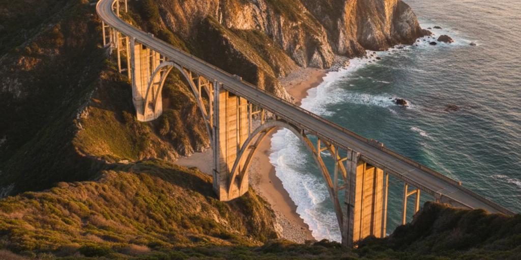
Bixby Bridge photographs best from the pullout on its north side in morning light, before the marine layer decides otherwise - do not stop on the bridge itself. McWay Falls is a short overlook walk in Julia Pfeiffer Burns State Park; the beach is off-limits, so the postcard shot is the only shot, best late afternoon. Tunnel View in Yosemite is world-class in the hour after a storm clears, when mist peels off El Capitan. Joshua Tree's boulders want golden hour, when the rock turns orange and the trees go to silhouette. Glass Beach in Fort Bragg glitters at low tide - photograph the glass, leave the glass. Drones are banned in all US national parks.
If California were a country, its economy would rank around fourth or fifth in the world - it passed Japan in 2025, and the top spots reshuffle with exchange rates. The state holds the tree trifecta: the tallest (a coast redwood named Hyperion), the largest by volume (the General Sherman sequoia), and the oldest (a bristlecone pine over 4,800 years old). And Death Valley's Furnace Creek holds the highest air temperature ever reliably recorded on Earth: 56.7C, in July 1913.
Coachella takes over Indio for two April weekends - book desert lodging months out. Monterey Car Week in mid-August, capped by the Pebble Beach Concours, fills the entire peninsula and makes Highway 1 traffic memorable. The Rose Parade rolls through Pasadena every January 1 (January 2 when New Year's falls on a Sunday). And harvest season in Napa and Sonoma, roughly September to October, is wine country at its best and busiest.
The rave is legitimate: nowhere else strings surf beaches, 4,000-year-old trees, granite cathedrals, wine valleys, and the hottest desert on Earth into one drive, with food to match at every stop. The complaints are legitimate too: distances are brutal and the "quick detour" does not exist, gas is the priciest in the nation, the best campgrounds and tastings demand booking discipline, and late-summer wildfire smoke can gray out the views for days - check air quality before locking a September Sierra leg. Give the state two weeks instead of one and most gripes dissolve into the windshield view.
For long stretches, no - on any network. Coverage drops between Carmel and San Simeon with only small pockets near Big Sur village. Download offline maps, check Caltrans QuickMap for closures before you start, and treat the drive as offline time.
No - the timed-entry system was dropped for 2026; you drive in with just the entrance fee (card only, no cash at the gates). The trade-off is crowds: on busy summer days Valley parking effectively fills by mid-morning, so arrive early or go midweek. Campsites and Half Dome permits still need advance booking.
Yes - one US plan covers the whole state, and your home number stays live for bank codes. The gaps in Big Sur, Death Valley, and Joshua Tree are physics, not plan limits; no local SIM fixes them either. Size the plan with headroom, download offline maps, and that is the whole connectivity decision.