Kathmandu runs on Ncell and Nepal Telecom, and your eSIM rides one of them as its host. The valley is well covered - 4G across Kathmandu, Patan and Bhaktapur, with 5G arriving in parts of the capital. Coverage in the city is genuinely fine. What this page is really about is what happens when you leave it, because almost everybody who comes to Kathmandu is on their way somewhere higher.
This is the rule that has changed most recently and the one most likely to derail a plan.
Since April 2023, Nepal has required trekkers in national park areas to travel with a licensed guide. Solo independent trekking, which was for decades the classic way to walk the Annapurna and Langtang routes, is no longer permitted in those areas. The change was made on safety grounds after repeated incidents involving lost and unsupported solo walkers.
What this means in practice:
- Budget for a guide as a fixed cost of the trek, not an optional extra.
- Permits - the TIMS card and the relevant national park or conservation area permit - are arranged in Kathmandu before you go, and a licensed agency will handle them with you.
- The Everest region operates its own permit arrangements through the local rural municipality, in addition to the national park permit, so check the specific requirement for your route rather than assuming one rule covers Nepal.
Rules here move. Verify the current position for your particular trek when you book, rather than relying on a blog post - including this one.
Nepal is better connected at altitude than most people expect, and worse than the headlines suggest.
- Ncell and Nepal Telecom both reach a long way up the main trekking routes. There is service in Namche Bazaar and at points along the Everest Base Camp trail, and the Annapurna circuit is reasonably covered in the villages.
- It is village coverage, not route coverage. The passes, the long climbs and the high camps have nothing. Thorong La, Cho La, the ridges - these are gaps, and they are exactly where trouble happens.
- Altitude and cold destroy batteries. A phone that lasts two days in the city lasts hours at 5,000 m. Carry a power bank, keep it inside your jacket, and expect charging in teahouses to be paid for and slow.
- Satellite communicators are increasingly standard on the higher routes, and any reputable guide will carry a means of calling for help that does not depend on a handset.
Download your maps, your permits and your itinerary before you leave the valley.
Tribhuvan airport in fog. Not a coverage problem but a connectivity one: winter fog closes the airport, and the Lukla flights that start the Everest trek are cancelled for weather routinely. Build spare days into the itinerary, and expect to be rearranging things by phone.
The Lukla flight itself is short, spectacular and often delayed for days rather than hours.
Inside the temples and stupas - the deep interiors of the Durbar Square buildings, Pashupatinath's courtyards - is stone and crowd.
The valley rim - Nagarkot, Chandragiri, Shivapuri - is patchy on the trails and fine at the viewpoints.
- Pathao and inDrive are the ride-hailing apps that work here, and both do motorbike taxis, which are the fastest way through Kathmandu's traffic and how a lot of the city moves.
- Maps, offline and comprehensively. Kathmandu's streets are a genuine maze, addresses are landmark-based rather than numbered, and Thamel in particular defeats first-time visitors.
- An air quality app. This is a real one for Kathmandu - see below.
- A weather app for the mountains, which decides whether you fly.
- A translation app. Nepali is the language; English is widely spoken in the tourist economy and in Thamel, less so beyond it.
Kathmandu sits in a bowl ringed by hills, and in winter the air stagnates. Between roughly December and March, and again during the spring forest-fire season, air quality in the valley regularly reaches levels that are unhealthy rather than merely unpleasant.
Practically: check the index rather than the forecast, carry a proper mask if you are sensitive, and know that the haze also closes the mountain views that people come for. Autumn - October and November - is clear, dry and by a distance the best time to be here.
Tribhuvan International (KTM) is about 6 km from Thamel, twenty minutes on a good day and considerably more in traffic. The airport has a reputation for chaos that is not entirely undeserved, though it has improved.
Visa on arrival is available to most nationalities - fill the form, pay in cash or by card, queue. Have a passport photo and the fee ready.
The Nepali rupee is the currency and Kathmandu is substantially cash-based outside hotels and the larger restaurants. ATMs are common in Thamel with modest withdrawal limits.
Modest in the city, and front-loaded for the mountains, where the point is what you downloaded rather than what you can fetch.
For a two-week trip with a trek, 1GB per 3 days is a fair baseline, most of it spent in the valley at either end. Plans top up from your dashboard when you are back down.
Layers, always. The valley is warm by day and cold at night in winter, and if you are trekking you are packing for a range from 25C to well below freezing.
Proper boots, worn in before you fly. This is not the place to discover a blister.
Modest dress for the temples. Shoulders and knees covered, shoes off, and leather belts and bags are not permitted in some Hindu temple areas.
A mask in the winter months, for the air.
Something for rain if you are here in the monsoon, when it comes down hard and the streets flood.
Boudhanath stupa at dusk, with butter lamps and the kora - the circuit of pilgrims walking clockwise - and the painted eyes above.
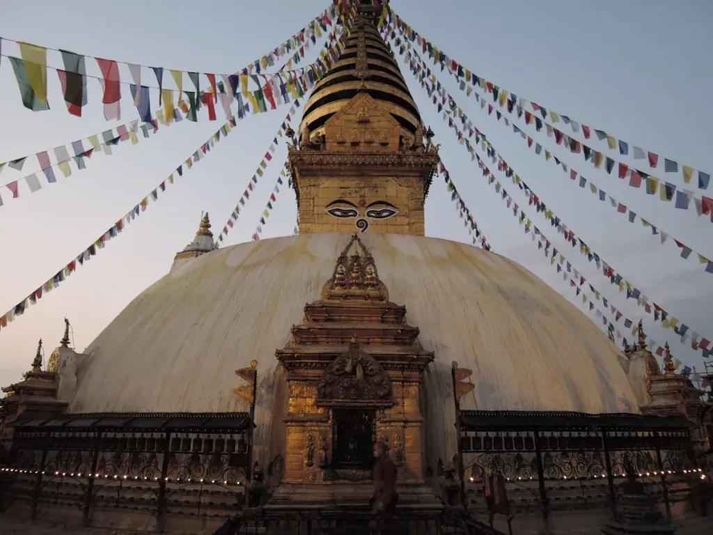
Swayambhunath, the hilltop stupa reached by 365 steps, with the whole valley behind and macaques everywhere.
Patan Durbar Square in the late afternoon, which is the best preserved and least crowded of the three.
Bhaktapur, a medieval city that still functions as one, and the most complete of the valley's old towns.
Pashupatinath on the Bagmati, where cremations take place in the open - approach it with real care and respect, and do not photograph the ghats or the families.
The Himalaya from Nagarkot at dawn, on a clear autumn morning, when the whole range appears above the haze.
Nepal's flag is the only non-rectangular national flag in the world - two stacked pennants.
The country runs on UTC+5:45, one of the few 45-minute offsets anywhere, chosen so that the meridian passes over Gaurishankar rather than to match a neighbour.
Nepal was never colonised, which is why its architecture, calendar and script survived in a form its neighbours' did not.
Eight of the world's fourteen peaks over 8,000 m are in Nepal, including Everest, which Nepalis call Sagarmatha and Tibetans Chomolungma.
And the 2015 earthquake killed nearly 9,000 people and badly damaged the Durbar Squares; the restoration has been long, is largely complete, and is visible everywhere you look.
Dashain, in September or October, is the largest festival of the year - the city empties as people return to their home villages, and much of Kathmandu closes for days.
Tihar, the festival of lights, follows a fortnight later, with marigolds, oil lamps and dogs garlanded and honoured.
Indra Jatra in Kathmandu Durbar Square, with masked dances and the chariot of the Kumari, the living goddess.
Autumn, October and November, is the main trekking season - clear air, stable weather, mountain views. March to May is the second season, warmer and hazier. The monsoon, June to September, is wet, green and quiet, and winter is cold and foggy in the valley.
The love: Kathmandu is intense, ancient and completely singular - a valley of medieval cities where Hindu and Buddhist practice sit on top of one another and both are entirely alive rather than preserved. Boudhanath at dusk is one of the great experiences in Asia. It is inexpensive, Nepali hospitality is famous, and it is the gateway to the greatest mountain range on earth.
The complaints are consistent. The air, in winter especially, is genuinely bad and it affects people. The traffic and noise in the centre are relentless, and Thamel is a hard sell to anyone hoping for serenity. Infrastructure is patchy - power cuts, water, roads. Earthquake damage is still visible in places and some sites are less than they were. And the city is a means to an end for many visitors, which means it often gets one rushed day at each end of a trek and is judged on that.
Give the valley three days rather than one, do Patan and Bhaktapur properly, come in October, and book the guide early.
Not in national park areas. Since April 2023 a licensed guide has been required for trekkers there, so solo independent trekking on routes like Annapurna and Langtang is no longer permitted. Permits — TIMS plus the relevant park or conservation area permit — are arranged in Kathmandu, and the Everest region has additional local requirements. Rules change, so confirm the current position for your route when you book.
In the villages, often yes - Ncell and Nepal Telecom reach a long way up the main trails, including Namche Bazaar and points on the Everest Base Camp route. The passes, high camps and long climbs between villages have nothing. Cold destroys batteries at altitude, so carry a power bank and download everything before you leave the valley.
Weather, almost always. Winter fog closes Tribhuvan and mountain conditions cancel the Lukla flights routinely - sometimes for days rather than hours. Build spare days into any itinerary that depends on that flight.
Roughly December to March, and again in the spring fire season, when the valley traps pollution and readings regularly reach unhealthy levels. It also hides the mountains. October and November are clear, dry and the best time to visit.